|
| Book Information |
Book Image |
|
| Name:
|
|
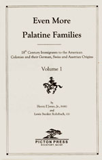
Even More Palatine Families, Volume 1
|
| Author:
|
|
Henry Z. Jones, Jr., FASG, and Lewis Bunker Rohrbach, CG
|
| Page:
|
|
224
|
| Publisher:
|
|
Picton Press, Rockport, Maine
|
| Year:
|
|
2002
|
|
|
|
|
Jones's continued study of the German Immigrants who arrived in Colonial New York has Johann and Sarah "Haas" coming to America from Oberweiler in 1740.
|
|
William and Simon probably had brothers and sisters, but half of all children at that time died before they were 16. Simon and William were both probably delivered at home, with the assistance of a midwife. In early colonial culture, children were sort of left on their own for the first few years. Parents at that time loved their children but didn't get too close, because most children didn't live to the age of eleven. Each son probably wore a dress through most of their infancy, and a "puddinghead cap" to protect the cranium until it hardened. They were raised in the unisex fashion of the time, and not considered a "men," until they were about six. Then they were old enough to be "breeched"—the dress was taken away, the long hair was shaved, and they were given long pants—officially becoming part of the family labor force. They probably had very little schooling. Just enough to learn a trade between chores on the farm, and basic math so he wouldn't get swindled by peddlers or shady customers buying their farm goods. Most of their teens would've been spent working in the field.
For their first few years, they would have been raised chiefly by Sarah, until they were old enough to work in the fields with John. Not only did Sarah have to do that herself, she had to cook, clean, spin and make clothing, milk the cows, carry the water, make soap, butcher livestock, smoke and preserve meat, and act as the family doctor. She cooked over a large open fireplace, while the children had to keep the fire lit day and night. Large pots, up to forty pounds when full, were used to boil liquids, render fat, simmer stews, and cure meat. Frying was done in large, long-handled, three-legged, cast-iron frying pans placed directly over the coals. Maneuvering these heavy utensils with boiling liquids and hot foods was dangerous. Thousands of women were severely burned or even killed in cooking accidents, especially when long dresses, petticoats, or aprons caught fire. And if that wasn't dangerous enough, she had to protect the family from Indians, outlaws and British forces while John was away, fighting in the militia!
At night, sons William and Simon probably slept alongside their sexually active parents in bed! (Privacy was not an option in the wilds of Colonial America.) At least John and Sarah kept their clothes on, as Northern Europeans usually wore their shirts and shifts during sex. (A person wearing a shift was described as "naked," while actual nudity was described as "from nature." And people were only "from nature" when they were getting flogged by officials in the village square, not in the bedroom.)
During the early-to-mid 18th Century, Johannes ("John") Haus moved into a more diverse area along the New York/New Jersey border, which had become a melting pot of Dutch, German, and British neighbors, near present-day Rockland County (it lies just north of the New Jersey-New York border, west of Westchester County across the Hudson River, and south of modern Orange County). In doing so, it can be speculated that the name "Johannes" changed to "John," and his German "Haus" surname change into the Anglicized "Hause" and "Hawes" in public records, written by census takers and land officers.
Most of the area around the Hudson and Bergen had been settled by the Holland Dutch. In 1664, when the British seized the land, it was deeded to the Board of Proprietors of East Jersey. The purchase of the Ramapough Tract from the Lenni Lenape in 1709 was a big event. It opened up 42,500 acres for purchase or lease, running from Torne Brook in Rockland County to the rock at Glen Rock, from the Ramapo Mountains east to Saddle River. In 1683, the Duke of York (who became King James II of England) established the first twelve counties of New York (present-day Rockland County was part of Orange County). Orangetown was created at the same time under a royal grant, originally encompassing all of modern Rockland County. Around this time, as the English began to colonize Nyack and Tappan. Much of the area was available along very old Indian trails which usually followed the streams and other water areas. This was true of the Ramapo Turnpike—where John would settle—as well as Paramus Road and the Plank Road over the meadows. These roads possibly started as an Indian trail, as the area was originally inhabited by Algonquian-speaking Indians, including Munsees, or Lenni Lenape (called "Ramapos" and "Hackensacks" by early European settlers).
As the population grew, small villages began to emerge: Jockey Hollow (New Milford) in 1724; Postville (Edenville) in 1734, Brookland (Florida) in 1730, Sugar Loaf in 1746, Wawayanda (Bellvale) in 1740, and Warwick Village in 1764. These hamlets grew as centers of social and commercial activity, and were all within a comfortable day's journey for the settlers. The village of Haverstraw was separated from Orangetown in 1719 and became a town in 1788; it included the present-day Clarkstown, Ramapo and Stony Point. (So when you see "Haverstraw" or "Tappan" or "Ramapo" in different documents or Hause family histories, remember it's all really the same area.) As the English began to colonize Nyack and Tappan, the Native Americans began to retreat into the Ramapo Mountains, and areas further north.
Settlers like the Hause family hunted, farmed, traded with their neighbors, making them for the most part self-sufficient, hardly involved with the colonial government, and their British rulers hardly seemed present at all. In 1750, however, the British authorities passed the Iron Act, which demanded the closing of many of the iron forges in the colonies, including the one at Bellvale, in an effort to keep the colonials dependent on the British iron industry. The Bellvale forge had been established around 1745 by Lawrence Scrauley as a tilt-hammer iron forge, from which he turned out products whose manufacture was now outlawed by the British Crown. It was the only mill of its kind in the New York Province. The Bellvale forge refused to close and the government retaliated by destroying it in 1750. Increasing restrictions, duties, and taxes increased the dissatisfaction of these independent people with a government that was distant from their homes, distant from their cares and concerns. Suddenly all of the British regulations, laws and taxes were becoming an issue with the colonists as they grew more independent:
THE LAWS OF COLONIAL NEW YORK |
|
The New York Colony instituted the Duke's Laws of 1665. Under these laws, offenses such as striking one's mother or father or denying the "true God," were punishable by death.
Following a slave revolt in 1712, the New York Assembly passed "An Act for the suppressing and punishing the conspiracy and insurrection of Negroes and other Slaves," and also prohibited free blacks ("an Idle slothfull people") from owning real property.
Voters were required to have a £40 freehold, in addition to requirements related to age, sex, and religion. However, the freehold requirement was often ignored.
Jews were not allowed to vote between 1737 and 1747.
Prostitution was not an offense, but it was regulated as a specific sort of vagrancy under laws against adultery or fornication or for being 'common nightwalkers'—women who strolled the streets at night for immoral purposes.
Homosexuality was punishable by death: "If any man lyeth with mankind as he lyeth with a woman, they shall be put to Death, unless one party were Forced or be under fourteen Years of age, in which Case he shall be punished at the Discretion of the Court of Assizes." After the Revolution, on February 14, 1787, the New York state legislature also passed a law explicitly enforcing the death penalty.
|
"Father, we are famished; give us fresh meat; we wish to eat the English."
—Ottawa and Potawatomi war song to Gov. Vaudreuil; Chanted at Montreal Conference, December 1756.
During the 1750's the French and Indian War, also called the Great War for the Empire, engulfed the New York Frontier, and changed the map of North America. The battles that occurred between 1753 and 1760 took more lives than the American War of Independence, making it the bloodiest conflict fought on American soil in the eighteenth century. The French from Quebec and the Native Americans of the Upper Hudson River Valley laid siege to the British frontier settlements of New York, and the only protection that the besieged farmers in these settlements had was the British Army—which unfortunately was stationed as far away as Albany, several days' march away.
When the western settlements of Orange County were attacked and destroyed by natives, the whites in the Valley called upon Thomas DeKay to organize a regiment for defense. A large blockhouse for protection was built across from what is today Warwick County Park (Hickory Hill). Survival dictated that every male colonist be both settler and soldier. The colonists reverted to the old English fyrd, general levy, or "militia," as it was coming to be known. Under this system every able-bodied man was enrolled for local defense. Virginia and other southern colonies followed the British organization, dividing the colony into counties, each supervised by a lieutenant. In New England, New Jersey, and New York the town was the militia's basic unit, although the county was retained as an element of higher control. So these frontiersmen took matters into their own hands and established local militia for their common defense, and German-speaking immigrants from all over the colonies joined up. They had been fighting the French for years, back to their days in the Palatinate, so they were ready for battle, and could be ruthless in the defense of their hard-won land. Many remaining Minsis had emigrated to western New York but a few remained friends, urged and supported by Dekay, and helped protect the settlers from the attacking forces.
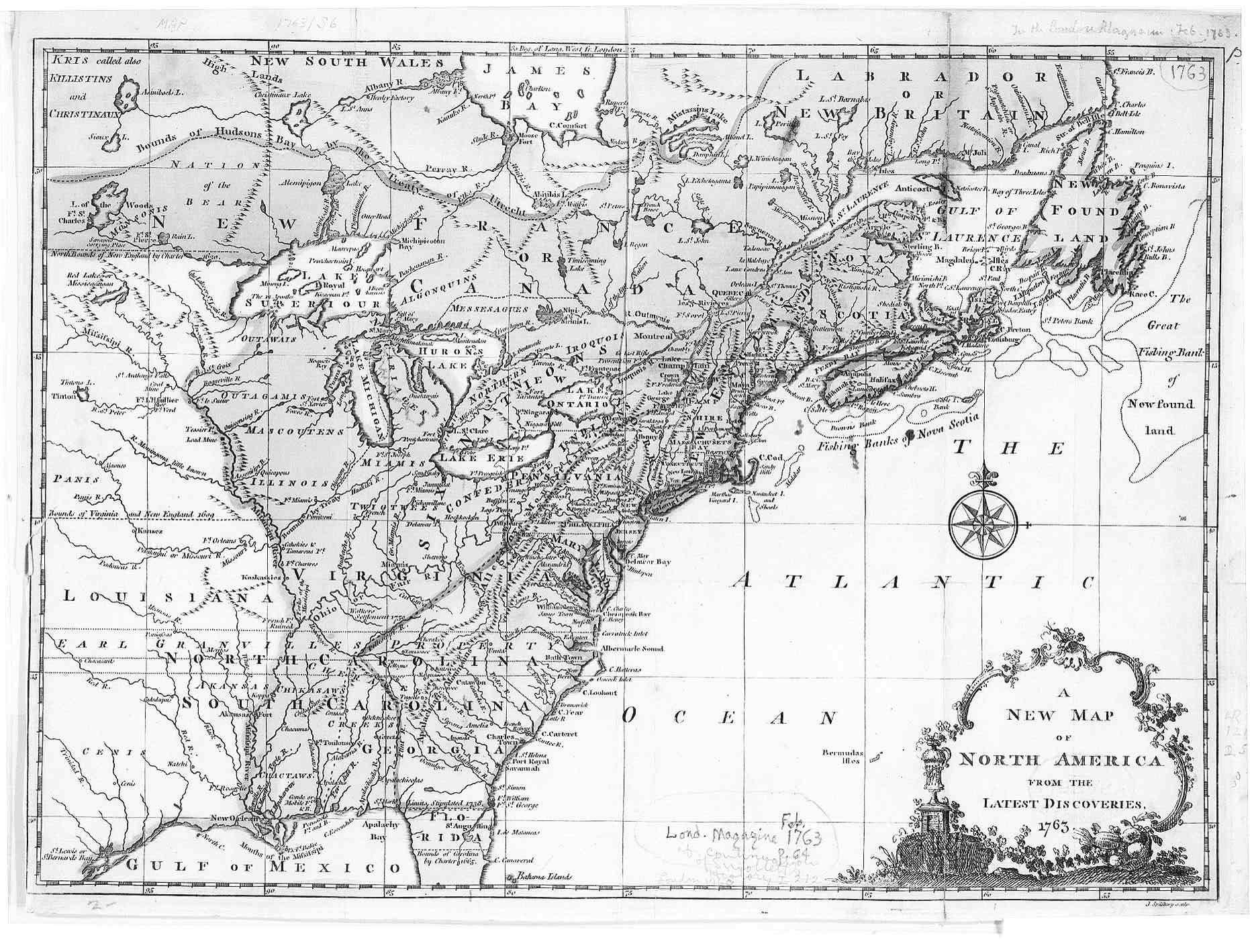
But many colonists felt they needed protection from the British government, as well. After the war, the British Empire controlled all of North America from the East Coast to the Mississippi River, and from Canada down to Florida (which was owned by Spain). But the cost of the war had been immense, and the British Treasury was nearly bankrupt, while the national debt had doubled. Parliament decided that the people of the colonies, now safe from the French, needed to pay off more of the debt, and began creating and raising new taxes, such as the "Stamp Act" in 1865, which taxed taverns for their licenses. This outraged local tavern owners in the Valley such as Francis Baird, and since the taverns were the hub of social life for many residents, the criticisms of over-taxation spread. Soon the colonists began to tire of all of the new tariffs paid to a king who they never saw, who underpaid them for raw materials for British factories (the King made sure that the colonists couldn't create finished products, in order to preserve their economic servitude).
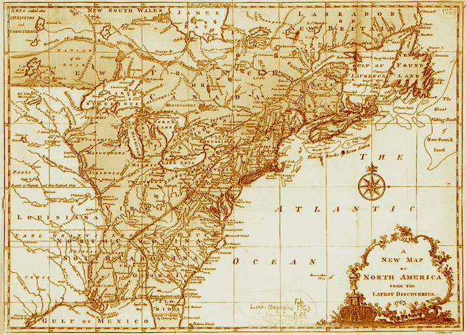
"A New Map of North America, from the Latest Discoveries, 1763." (Click here to enlarge.) |
|
| Book Information |
Book Image
|
|
| Name: |
|
The Minutes of the Board of Proprietors of the Eastern Division of New Jersey, Vol. III, from 1745 to 1764 |
| Publisher: |
|
Quinn & Boden Co., Inc., Rahway, N. J. |
| Year: |
|
September, 1960 |
| Pages: |
|
305-310
398-407 |
|
|
|
|
Published by the General Board of Proprietors of the Eastern Division of New Jersey in an edition of 500 copies.
|
|
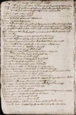
John Hause lived near his brother (or son), Simon, on the Ramapo (or Romopock) Patent, a small settlement on the Ramapo River in the province of New Jersey.⁵ It was a colonial tract of land in Bergen County, under the administration of the East New Jersey Proprietors. The 42,500-acre patent had been created in 1710, and included most of the northwestern portion of Bergen County, which was the first permanent "Dutch" settlement in New Jersey. The lands today spread from northwestern Bergen County, New Jersey, to Rockland County, New York. The area was at that time just a small collection of farms and mills, connected by dirt paths and rugged roadways.
On the 18th of August, 1756, a lease for land there was executed (No. 184 of the Ramapo Tract) to "John Hase," which consisted of 109 acres at 12 s 6 per ann. for 3 years "from 24th March last" (Source: The Minutes of the Board of Proprietors of the Eastern Division of New Jersey, Vol. 3, from 1745 to 1764, p. 306, at right). The truth is, John had probably already improved the land, but a legal technicality had invalidated all previous land sales, and John and the other farmers had discovered that they would have to lease their own property from new owners! Then on the 19th of August, 1763, the Board executed another lease at Romopock to "John Hawse," at lot no. 171, consisting of 91 acres at 20 s, starting back on August 11, 1763 (Vol. III, p. 404, chart). He's living near Simon Hawse (who is on page 403). But ownership of the Hause family's land, on the contested border between New York and New Jersey, would be tied up in controversy that would be unresolved until the next century, when it was decided which state actually held the land.⁶
The New York/New Jersey border in the area of Orange County, at the time that the Hause family lived there. |
|
| Personal Information |
Census File
|
|
| Name: |
|
Hawes, John |
| District: |
|
5 (near Wickham's Pond) |
| County: |
|
Orange |
| State: |
|
NY |
| Year: |
|
1775 |
|
|
|
|
SOURCE INFORMATION: "History of Orange County, New York" by E.M. Ruttenber and L.H. Clark, 1881 (pages 566, 567).
|
|
Over the next few decades, John either moved north a few miles on the Wayawanda Patent, or the state borders changed. While in the same general area, a 1775 Assessment Roll of Orange County lists John as a living near Wickham's Pond in Warwick, Orange County, New York, along the King's Highway. This 1,300-mile road was the most important in colonial America, serving as the major route for for trade and transportation of goods in the colonies. It was built on the order of Charles II in 1664, directing his colonial governors to link Charlestown in South Carolina to Boston in Massachusetts; When it was fully completed in 1735, it was still basically a trail: Wagons and stagecoaches used it, but it was difficult going with few bridges and many river crossings. Sections were often impassable.
The list places the land of "John Hawes" in District five of Warwick (comprising the territory in the vicinity of Wickham's Pond, including Bellvale Valley). While Warwick was listed as his home town, it didn't officially exist yet—Warwick was just the name peiople had adopted for a precinct of Goshen, the county seat, and contained a wide area of hamlets, cloves and untamed land, running down to the New Jersey border. The area where Hauses lived was a natural pass that straddled important trade routes and the main line of land communication between Canada and New York. (The area today intersects Routes 17, 287, and the Thruway.) John was named a "Highway Master" for the section where he lived at a meeting in Haverstraw for 1770.⁷ Five years later, he was chosen as a Pathmaster in District 45 at a meeting for Cornwall, a new Precint that had been created in 1764, comprising of the present towns of Cornwall, Highlands, Blooming Grove, Monroe, and parts of Chester and Hamptonburgh. (History of Orange County, New York, by Edward Manning Ruttenber and Lewis H. Clark; published in 1881 by Everts & Peck; page 760).
Very few records are available for Colonial Orange County today; the courthouse where they were housed had an extensive fire during the 19th Century and nothing was saved. However, the 1775 assessment roll had been recorded for a history book and was therefore preserved.
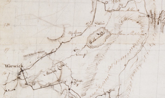
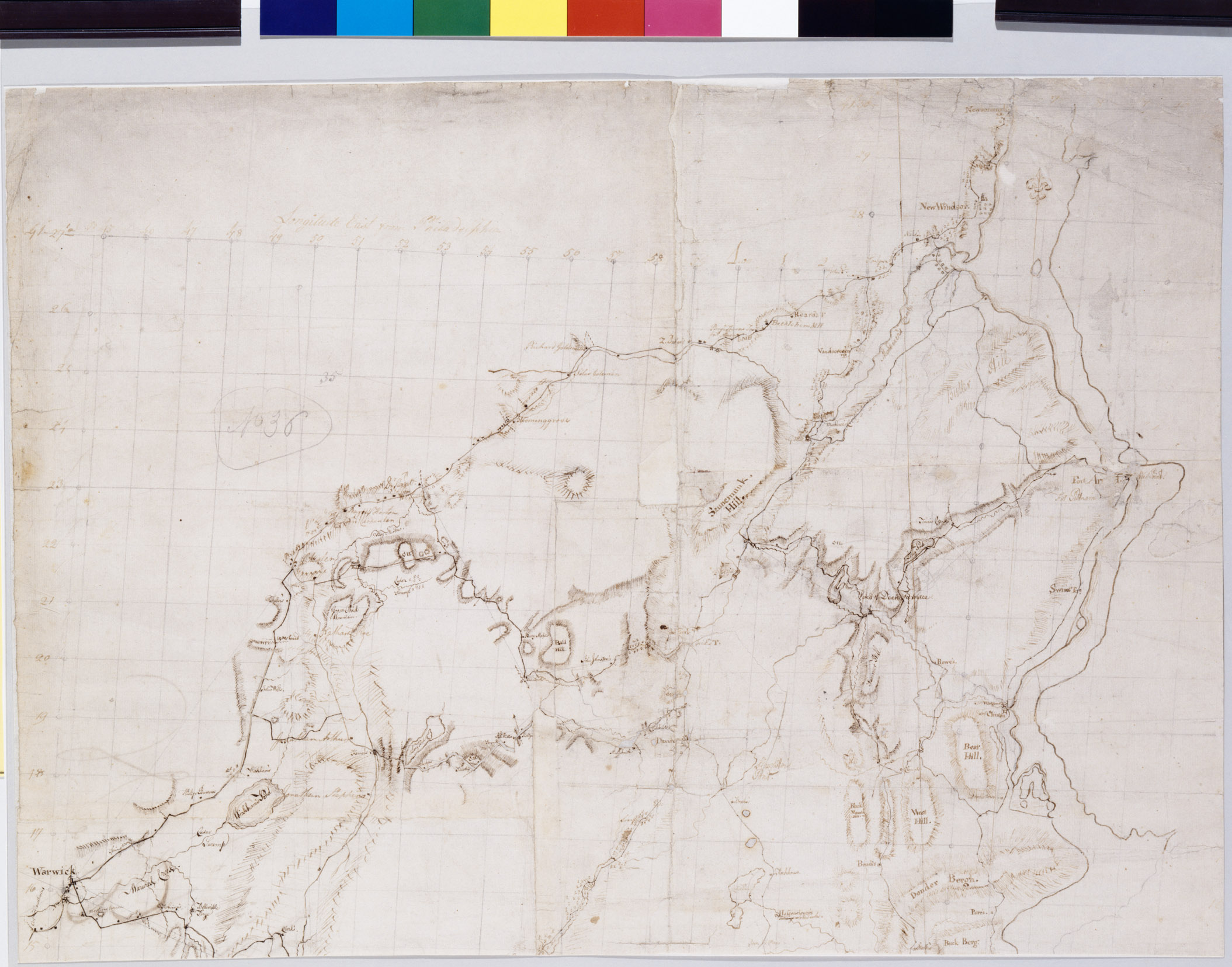
"From Newborough (Newburgh) to Fort Lee, No. 36" by Robert Erskine, Washington's map maker during the war. This military topographic map covers Orange and Rockland Counties in New York and Bergen, Passaic, Morris and Essex Counties in New Jersey. Erskine drew several maps of the Warwick area and its strategic points. This one shows Wickham's Pond, where John Hause was listed in the 1775 Warwick census. Collection of the New York Historical Society. |
This area John and his brother lived in, known as "Wawayanda"—approximately 150,000 to 194,000 acres—was secured from 12 Minsi (Munsee) Indian chiefs in the early 1700s for $350, whiskey, cloth, and trinkets. It was located on the west side of the Hudson, fifty miles north of New York City, in the heart of the "Black Dirt Region," known for two highly prized products sticking out of the dirt: Onions and mastodons. The wide flat valleys were once a glacial lake, which became a swamp and later dried, leaving its rich black dirt. Decomposition was slow under the muck without oxygen, so mastodon bones were still easily found. But more importantly for farmers like John Hause, the rich organic soil was also perfect for growing onions.
The first permanent settlers after the Native Americans in the Warwick area were mainly Dutch and English. In 1719, an Englishman named Benjamin Aske had purchased land in the southern valley of the patent and established a farm, which he called Warwick, probably named after a town in west-midland England near his family's ancestral home, and the name was eventually adopted for the surrounding hamlet and town. On 29 Oct 1736, a certificate for laying out a "King's Highway" was recorded by the Commissioners of the Precinct of Goshen, which improved the ancient Wawayanda Path and created a more convenient route for travel, opening up the area to white settlement—and hastening the departure of the local Minsis.
The Hause family most likely lived in one of the many log cabins erected in the area. There were no sawmills, so clapboard houses were only available to the very wealthy, who could afford to import the lumber. Its first stone house wasn't built until 1771.
|
WARWICK IN THE 18TH CENTURY
|
| NOTE: Every day in 1976, a Warwick Bicentennial Committee, researched and aired a one-minute segment on WTBQ about Warwick's History. They were called "Bicentennial Minutes." Here are a few:
In January of 1745, Thomas DeKay, who was the grandson of a Dutch immigrant to New Amsterdam and a colonel in the Colonial Militia, was so trusted by the Indians that he represented them in Goshen where their pledge of brotherhood to the English was renewed. The ceremony of friendship included DeKay's being chained to the Indians for an hour, during which they gave him a wampum belt to be sent to the governor of New York in token of their friendship. Warwick settlers kept their pledges to the Indians which helped in DeKay's good relations. Instead of collecting bounty on Indian scalps offered by the New York Legislature in 1746, DeKay helped distribute fifty pounds payment to Indian scouts of Orange County.
Daniel Burt Jr. of Warwick and Martha Bradner from Wisner, were married on January 25th 1770, and moved into the Old Shingle House on Forester Ave. The house was begun in 1764 and was the first structure in the village. Daniel's father and uncle Benjamin Burt, had first seen Warwick in 1764 when they came from Ridgefield, CT and bought land from Benjamin Aske, one of the original grantees under the Wawayanda Patent. In 1760, Daniel Burt Sr. after selling his original land, the present Welling Farm, and then land in Bellvale, obtained 190 acres in Warwick where he built his own house and the Shingle Hosue for his son. The house (now a museum owned by the Society and open for tours during half of the year) is a well-preserved example of the saltbox type.
A famous hearing, drawing many nationally-known people, took place at Chester shortly after the Revolution, to determine the line separating the Wawayanda and Cheesecock Patents. The Wawayanda Patent had been granted on April 29, 1703, and the present Town of Warwick is located within it territory. However, the land encompassed by the patent was so vast, and its boundary descriptions were so vague, that they remained uncertain for more than eighty years. The hearing was held under the jurisdiction of Aaron Burr, who was the attorney general and commissioner of public lands for the State of New York at the time. The heirs and successors of the Wawayanda patentees were represented by no less a lawyer than Alexander Hamilton.
Warwick became a town under the General Act on March 7th, 1788. Prior to this time Warwick was a part of the old precinct of Goshen. The first town meeting was held the first Tuesday in April, 1789, with John Smith as town clerk and John Wheeler as supervisor. Assessors, commissioners of roads, overseers of the poor, collectors, constables, road master and fence viewers were appointed. For the benefit of the poor, 100 pounds, or approximately $500 was to be raised; 20 pounds or approximately $100 was set aside for all other expenses.
In the year 1797, Francis Baird was elected town clerk, and Robert Armstrong was elected supervisor. At the town meeting, 68 pounds was voted for support of the poor and four pounds as an additional sum on wolves' heads. The apportionment of the school monies by the supervisor of the county to the several towns in the county was as follows: Cornwall, 140 pounds, thirteen shillings; Goshen, 82 pounds, ten shillings; Warwick, 101 pounds, nine shillings; Minisink, 76 pounds, fourteen shillings.
In April of 1800, Francis Baird was elected town clerk and Jacobus Post was elected supervisor. It was voted to raise 150 pounds for maintenance of the poor. Fifty-six pounds and sixteen shillings was raised from licenses and permits. These licenses and permits were for the operation of inns and taverns in the Town of Warwick. Additional monies were also raised by dog taxes.
In the early days the dentist was an unknown quantity in the area, so dental extractions were left to the doctor. Every doctor kept a formidable instrument called a turnkey, made of iron with a straight unplated shaft and a claw, for pulling "anticky" teeth. A dentist's chair was unknown, and if the offending molar proved hard to extract, the sufferer was laid on the floor on his back. The doctor then knelt beside him, pressing one knee in his diaphragm, and thus patient and tooth parted company.
|
"No one slept safely in his bed. Many families hid themselves at night in barns, wheat-ricks, corn-cribs, and stacks of hay; and on each returning day, blessed their good fortune that their houses had escaped the flames."
—Historian Joshua Hett Smith of Haverstraw, in a contemporary account of the plight of its terrified inhabitants in the years leading up to the Revolution.
Relations between the American Colonies and England were growing tense. There was a "Non Importation Pledge" to be signed in 1774, and after couriers who most likely arrived along the Hause property on Kings Highway brought news of the violent outbreak of hostilities at Lexington and Concord between the local Militia and the British, there was a "Revolutionary Pledge" drafted in 1775. Most of the people in the Warwick area signed the oaths, but Warwick was still split between Loyalists and Tories.
As a first-generation American native, John Hause felt no real allegiance to England, and resented the ever-increasing taxes he paid on food and necessities to a ruler who lived across the Atlantic, and he had never even seen—as well as a government he had no voice in, that did little to protect him on the frontier. He and many others of his generation felt it was time for a change... But instead of moving to a different land to escape an oppressive ruler—like their forefathers did—this generation decided to keep the land and change the ruler. They no longer wanted a protector controlling their lives. They wanted freedom.
By July, 1777, the American army under Washington was encamped in the vicinity of Ramapo. At least two of John's sons had already joined in the fight—his eldest son, Simon, and the man whose story comprises the next chapter of our family history—our proudest chapter:
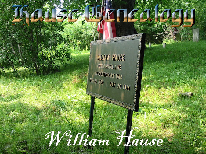 |
CHAPTER THREE: WILLIAM HAUSE, 1750 - 1818. A Revolutionary War hero helps save the Hudson River, then becomes a prosperous land owner. So John begat William who begat John who begat Augustus. Then Augustus begat a generation that moved west...
TOP PAINTING: "Autumn Light on the Ramapo River," by Jasper Francis Cropsey (1875)
|
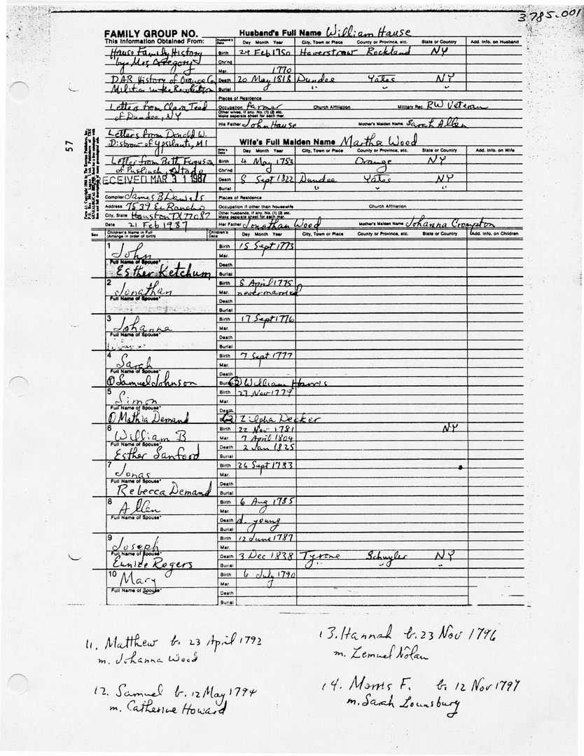
| Worksheet Information |
Worksheet Image |
|
| Genealogist: |
|
James B. Daniels |
| Client: |
|
Basil Hause |
| Date Submitted: |
|
31 Mar 1987 |
| Subject: |
|
Hause Genealogy |
|
|
|
|
SOURCE: Collection of Gerald Hause.
|
|
¹—In 1987, genealogist James B. Daniels, citing the Hause Family History by Mrs. Josephine Gregory, the DAR History of Orange County Militia in the Revolution, letters from Clara Spears-Teal of Dundee (her family bought William's Dundee property), New York, letters from Donald Disbrow of Ypsilanti, MI, and a letter from Betty Ferguson of Ontario, lists William as a son of John Hause and Sarah Allen, and has found no evidence of a "John Hause III," born in 1719. But the problem with this scenario is that Sarah Allen would've been almost sixty years old at the stated time of William's birth, which even today is a highly unlikely age for motherhood. (Johannes did, in fact, have a son named William in 1730, which explains the confusion, but he was 20 years older than our ancestor—and would've been SIXTY-SEVEN when our William had his last child.) Not to mention that despite over 100 years of looking, nobody has ever found any evidence that John Hause and Sarah Allen ever married, or even existed at all. No British 'Allen" family appears to have lived in this Dutch settlement, although there were many Van Alen lines. Although the surname Van Alen is Dutch, the family still claims to be of English royal descent—from JAMES THE FIRST, King of Scotland, and his wife LADY JANE DE BEAUFORT, a descendant of EDWARD III, King of England. How's that for "fine British blood?"
|
| Personal Information |
Deed Image |
| Granter: |
|
House, Rinert Sr. |
| Grantee: |
|
House, Johannes |
| Township: |
|
Haverstraw (present-day Clarkstown) |
| County: |
|
Orange (present-day Rockland) |
| Province: |
|
New York |
| Date: |
|
3 Apr 1756 |
| Price: |
|
$100, "hand-paid" |
|
|
|
SOURCE INFORMATION: Clerk's Office, town of Clarkstown, Rockland Co., NY; 10 Maple Avenue, New City, NY 10956 (845) 639-2000. Website
|
|
²—This would be Johannes Haus, baptized at 9 weeks old on 29 May 1726, to parents Reinhard Haus and his wife, Anna Elisabeth. Witnesses were Hannes Moots & Anna Marie Veltin. (Source: Dutch Reformed Church Records from New York and New Jersey. Holland Society of New York, New York).
Johannes's father, Rheinhardt Haus, was married around the year 1715 (the same year that John Hause marries in the family legend) to Anna Elisabeth (the last name varies in different documents), and was naturalized on January 10, 1715/16 as "Rynier Hous" and listed in Phillipsburgh, New Jersey (in present Westchester County). Eventually, he moved to Hackensack in Bergen County according to the "Simmendinger Register."
Johannes married Sarah Wheeler (or Weiler), from a prominent local family based in Kinderhook, Columbia County.
The only problem I have with this theory is that I have taken a Y-DNA test and compared it with another male claiming descendancy from Rheinhardt and we are not a match, so either this is the wrong line, or one of us was adopted!
³—This would be Johannes Haas, baptized on 11 Nov 1716 to Palatine immigrant Simon Haas (b. 1661) and Anna Rosina Zöller (b. 1690), according to genealogists Kirk Moulton and Dan Kinsey, working on the Secord and Simon Haas families (Source: Holland Society of New York; New York, New York; New York City Lutheran, Vol I, Book 85). They say Johannes married Sarah Wilkensen (b. 1720) in the 1740s and believe that my line of the Hause family descends from this man... but no direct male descendants have been found to compare my Y-DNA with, so it is still unproven. Still, according to German naming tradition, the most common pattern would be for sons to be named in this order:
first born, for father's father
second born, mother's father
third born, father of the child
fourth born and on, uncles of the child
In that tradition, if Simon truly was the eldest son of John Hause, as it says in our family lore, then the father of John Hause of Warwick would have been named Simon. This was a common name for many generations in my Hause line during the 19th Century... but this point is mooted because there are other names from Simon's line such as "Nicholas" and "Bernard," who would have been uncles, that don't appear at all. But hey, I'm open...
⁴—William's birthdate changes from 1750 to 1751 because Britain and its colonies changed from the old style (Julian) calendar to the new style (Gregorian) calendar on January 1, 1752. But this change had occurred in Holland about 170 years earlier, in 1582, and the Gregorian calendar therefore was used in the Dutch colony of New Netherland (New York). The colony of New Netherland operated according to the laws and customs of the Netherlands province of Holland, where the new calendar had been in use since Pope Gregory introduced it in 1582. Therefore New Netherland records are dated as we would date them today, with the year beginning January 1 and no double-dating.
But under the old calendar in use prior to 1752 in Britain and its colonies, the year began on March 25, and March was the first month, February the twelfth. Dates in January, February, and the first 24 days of March were often "double-dated" to indicate both the past and incoming years. For example, what we would call February 24,1714 would then have been February 24, 1713, but could also be written February 24,1713/14. It would also have been the 24th of the twelfth month, not the second month.
When the new calendar was adopted, eleven days had to be dropped, and this was done by declaring that the day after September 2,1752 was September 14, 1752.
After the English conquered New Netherland in 1664, and except for the brief return of Dutch rule in 1673-74, the old (Julian) calendar was used in official documents, but the Dutch often continued using the Gregorian calendar (or some aspects of it) in their church and family records.
Some genealogists have tried to convert all old style dates to their new equivalents, and published only the new forms, just like we say George Washington was born February 22, 1732, when at the time he was born the date was February 11, 1731/2.
⁵—The Proprietors spent much money seeing the land was properly surveyed, and it appears many survey maps survived. The survey maps for the Lots Nos. 184, 109 acres, and 171, 91 acres, that John Hawes possessed; along with the Lot No. 25 of Simon Hawse and Hans Jury Gable, will be found in the William Alexander Papers in the NYHS Library. He was the surveyor for the Proprietors of the Eastern Division of New Jersey (http://dlib.nyu.edu/findingaids/html/nyhs/alexander/dscref164.html).
| WILLIAM ALEXANDER PAPERS IN THE NYHS LIBRARY
|
| Box: 21
|
Folder: 3
|
Surveys—Bergen County—Ramapo Tracts—A - O
|
| Box: 21
|
Folder: 4
|
Surveys—Bergen County—Ramapo Tracts—P - Z
|
| Box: 21
|
Folder: 5
|
Surveys—Bergen County—Ramapo Tracts—Unidentified or Multiple Owners
|
|
Lot #184 John Hase, later Anthony Troutter abutters #183 Conraad Forsealman #185 Jacob Coole. This should be in Box 21, folder 3 under Hase, Foresealman, or Coole; Possibly under Troutter in folder 4. Lot #171 John Hawse. Abutters #170 Christian Pellisfelt, #172 Christine Carlegh. This should be in Box 21, folder 3 under Hawse or Carlegh; Possibly under Pellisfelt in folder 4. Lot #25 Simon Hawse and Hans Jury Gable. Abutters Coonrad Vryessen. This should be in Box 21, folder 3 under Hawse or Gable; Possibly under Vryessen in Box 21, folder 4. Outside maybe, in Box 21, folder 5 multiple owners. The close proximity that John Hause lived to the Iron Works is probably the reason the Proprietors of the West Jersey would accept the 300 cords of wood cut by John Hause and family as equivalent to 30£ cash. (https://babel.hathitrust.org/cgi/pt?id=mdp.39015027766313;view=1up;seq=410, https://babel.hathitrust.org/cgi/pt?id=mdp.39015027766313;view=1up;seq=415) Not only was he a Cordwinder, he was a good Cord stacker too. That is a lot of wood! (Courtesy of Dan Kinsey)
⁶—It seems like the Hause family was moving all over the place during the 18th Century—from Ramapo to Haverstraw, to Warwick—but a history of the counties in New York reveals that the names of their residences were changing more than their actual homes, as county and township boundaries moved practically every decade.
Orange County was one of the first twelve counties established by the Province of New York in 1683. It included parts of New Jersey and present-day Rockland County, but its boundaries were unclear, as much of it was wilderness. John Hause's land was in the Ramapo Mountains, a forested chain of the Appalachians. By the 170s John's land was between Warwick and Haverstraw, west of the Hudson River, east of the Delaware River and northwest of New York City.
Following the war, the area where the Hause family lived was still contested between New York and New Jersey. On March 28, 1800, an act passed by the New York Legislature dealing with a petition presented by John's son, William Hause (as well as the Ketcham and Sandford families), stated that William would be allowed to purchase the unpatented land that his family had settled and improved on the New York/New Jersey border, and it officially became New York. The area is now called Tuxedo Park, in Orange County, New York, about 17 miles from present-day Warwick and 30 miles from Haverstraw.
The towns of Clarkstown and Ramapo were drawn from Haverstraw in 1791. Rockland County split from Orange County in 1798, and Haverstraw is now in Rockland County. The current Town of Ramapo was formerly known as Hempstead, which was formed from part of the Town of Haverstraw in 1791. The name was changed to Ramapo in 1829, and it's located north of Bergen and Passaic Counties in New Jersey, southeast of Orange County, New York, south of the town of Haverstraw, and west of the towns of Clarkstown and Orangetown—about 7-10 miles north of the Ramapo patent land that John originally lived on. In 1808, the area of the Hause farm was changed to Monroe; On March 4, 1890, the Town of Tuxedo, containing that land, was separated from Monroe. Confused? Don't worry. I'm sure it'll change again, soon.
⁷—The Ramapo Pass has played more than one significant role in the history of New York State. The earliest settlers of New York were blocked by the steep Ramapo and Haverstraw mountains from migration into what is now Orange County. Albany, Ulster and Orange counties were all initially settled by travel up the Hudson River to Fort Orange (Albany). From there the Dutch settled Wiltwyck (now Kingston) and then many followed the legendary Old Mine Road from Kingston through the Minisink territory down into Orange County. Only after the early settlers cleared the Ramapo Pass and constructed a road along the old Indian trail, during the course of the 18th century, did upstate migration begin inland through what was to become Rockland County. The work of clearing and improving the pass for wagon travel was largely attributable to the Van Deursen (Van Duzer) and Sloat families, and Isaac Van Deursen III himself was one of the first to take advantage of this new route when he moved north to Cornwall. These early families also built inns in the pass to accommodate travelers. Lord Jeffrey Amherst, who stopped overnight at Sidman's Inn in 1761, described the path as "very stony and narrow."
The Ramapo Pass acquired strategic importance during the American Revolution when the city of New York was held by the British who hoped to gain control of the Hudson River. The Ramapo Pass served the troops of General Washington, who ordered improvements to the road and fortifications built at Sidman's Bridge to prevent the British from using the pass and to facilitate his own troop movements. From the Liberty Rock, which is the highest elevation in Sloatsburg and in direct line with the the Torne Mountain, communication was effected by signaling. The lookouts on the Torne were primarily on the alert for movement of British ships in New York Harbor, as Washington was concerned that they would advance up the Hudson River. This strategy, combined with the blockade of the Hudson River at West Point, prevented the British from capturing Albany and other areas of New York.
Over the years of the 18th and 19th centuries, the road through the Ramapo Pass became known as the Clove Road, then the Albany Post Road, and later as the Orange Turnpike and State Highway 17. During the 19th century, the pass continued to be important as part of the route of the Albany Stage and later the Erie Railroad. Even today, the Ramapo Pass serves as a major transportation route for the New York State Thru way and Route 17. (Source: Kuykendall, Gene: "South of the Mountains" newsletter, 1997, Vol. 41, No. 1; p. 13.)
SOURCES FOR THIS PAGE:
- City of Clarkstown (Haverstraw): Clarkstown Historical Records: 1752 - 1789: Johannes House/John Hause: Pages 47, 60, and 127; Clerk's Office, town of Clarkstown, Rockland Co., NY; 10 Maple Avenue, New City, NY 10956 (845) 639-2000.
- 1775 Orange County Assessment Roll, Page 567; Reprinted by Heart of the Lakes Publishing, Interlaken, NY, 1980, available in three volumes including a full name index from the Orange Co. Genealogical Society, 101 Main Street, Goshen, NY 10924. Ruttenber & Clark comment about the importance of the 1775 Assessment Roll as an early record of the country history, especially given the destructive fire which consumed the town clerk's office in 1842.
- History of Orange County, New York, by Edward Manning Ruttenber and L. H. Clark; Published in Philadelphia : Everts & Peck; 1881. P. 760: John Hause named path-master no. 45.
- Pictorial Field Book of the Revolution, Volume I, by Benson J. Lossing. 1850. CHAPTER XXXII
- Ramapo Lutheran Church Records, 1750-1817 in Proceedings of the New Jersey Historical Society, Vol. VIII, No. 1 (April 1913), p. 9
- People of the Valleys Revisited: History of Warwick, New York, 1700-2005, by Richard W Hull, Royal Fireworks Press, 2005.
- NYC Luth Church Burials (NYG beg. Jan. 1974)
- History of the Ramapo Valley.
- Map of the State of New York. Albany by De Witt, Simeon (1756-1834); Engraved by G. Fairman, 1802. Scale ca. 1:325,000. col. map 167 x 134 cm. on 3 sheets 61 x 138 cm. or smaller. Library of Congress: G3800 1802.D41. (Close-up here from the Albert Wisner Public Library).
- History of the Town of Cornwall.
- Haverstraw in the American Revolution (Haverstraw Brick Museum)
- Kuykendall, Gene: "The Van Duzer and Sloat Families in the History of the Ramapo Pass"; South of the Mountains, 1997, Vol. 41, No. 1. January-March 1997 newsletter of The Historical Society of Rockland County. Published by The Historical Society of Rockland County, 1997; newsletter; 24 pages (p. 13-
- A History of Claudius Boatman: Warwick, Orange County, New York - 1765 to 1777.
- Jones, Henry Z, Jr., The Palatine Families of New York, 1985, Vol. I, p. 350
- "Baptisms in the Lutheran Church, New York City" in NYG Record, July 1969, p. 166
- Information online Jan 2009, Dutch-Colonies List, from James Brady
- Mrs. Alberta Spaid Reeder, of Canoga, Seneca Co. New York
- Mrs. Josephine Gregory: 500 S Los Robles #320, Pasadena, CA. 91101
- Mrs, Charles Parker: 6286 Tower Ave., E. Lansing, MI. 48823
- Mrs. Alma Hawes (Lincoln): 314 W. Main St., Whitewater, Wis. 53190
- Hopeful Journeys: German Immigration, Settlement, and Political Culture in Colonial America, 1717-1775 (Early American Studies), by Aaron Spencer Fogleman. Publisher: University of Pennsylvania Press (February 1, 1996).
- History of Rockland County, New York, With Biographical Sketches of Its Prominent Men, by Cole, David. Publisher: J. B. Beers & Co, New York. 1884.
- Pioneer Families of Orange County, New York, compiled by Martha and Bill Reamy. Finksburg, Md. Pipe Creek Publications, c1993.
- The Revolutionary War in the Hackensack Valley: the Jersy Dutch and Neutral Ground, by Leiby, Adrian C. Published by Rutgers University Press. 1962
- Ridgewood, Bergan County, New Jersey, Past and Present, by the Citizens Semi-Centennial Association, Ridgewood, N.J. Publisher: Ridgewood, N.J., Citizens semi-centennial association. 1916.
- The Reformed Church In America, "Struggle For Eccesiastical Independence" (1708-1792). Pages 102-117
- Records of the Linlithgo Reformed Church, Livingston, Columbia, New York. Transcribed by Arthur C. M. Kelly, by the Reformed Church. Publication: (Rhinebeck, NY, Kinship, 1970)
- Baptismal Record of the Tappan Reformed Church, Regular Congregation, Tappen, Rockland, New York. FHL Microfilm #1016876. Microfilm of Cole Transcript of Tappan & Clarkstown, Reformed Church. One more possibility: Catharina Haus. b. 24 Dec 1751; Christening: 19 Jan 1752 Reformed Church, Tappen, Rockland, New York; Baptism: Baptism of Catharina Haus 19 Jan 1752 Reformed Church, Tappen, Rockland, New York. Sponsors were Jan Smit and Rachel [Compiler - Wheeler], his wife. Parents listed as Johannes Haas and Sara Wilkissen
- Ramapough Mountain Indians: People, Places and Cultural Traditions, by Edward J.Lenik; Ringwood, NJ: North Jersey Highlands Historical Society, 2011; pp. 1-4
- Corridor Through the Mountains: Smith's Clove: Wartime Line of Communication and Passageway for the Continental Army, 1776-1783, by Richard J. Koke. (purchase the full book here)
- Pure Necessity: Revolution at Warwick: The life and times of General John Hathorn, his militia, and the community of Warwick, New York in the late 18th Century, by Sue Gardner; Published by Wickham Thicket, Warwick NY (October 8, 2019), 365 pages.
- History of Montgomery Classis, by W.N.P. Dailey, 1916. "While the Holland Dutch first came to the New World in 1609, and at once established their church and school, it is noteworthy that all elements of the Reformed Churches of the American continent-from France and Switzerland, and the German Palatinate-the churches of the Reformed faith established in Virginia (at times meaning the Atlantic coast lands), and Maryland, and Pennsylvania-all turned to the Classis of Amsterdam (Holland) for men and money."
- German Naming Traditions Genealogists Should Know, by Diane Haddad, from the September 2012 issue of Family Tree Magazine.
- 1963 letter from Charles R. Hause: 532 Lange Court, Libertyville, IL. 60048: "Of John Hause, it has not yet been proved for sure that he hooks up to the rest of the Hause's as we cannot find out for sure the father's name of William Hause, Sr. It is believed that a generation is missing between John and William, and if it can be located perhaps this will hook the two together."
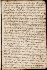
- Will of John Haus of Warwick, Orange Co. N.Y. Probated Sept. 5, 1796

CHAPTER 1: THE LEGEND OF JOHN (JOHANNES) HAUSE (1690-?)
CHAPTER 2: JOHN HAUSE OF WARWICK (1719-1794)
CHAPTER 3: WILLIAM E. HAUSE (1750-1818)
CHAPTER 4: JOHN HAUSE (1773-1844) AND WESTERN NEW YORK
CHAPTER 5: AUGUSTUS HAUSE (1804-1875) AND THE ERIE CANAL
CHAPTER 6: LABAN AUGUSTUS HAUSE (1831-1906)
CHAPTER 7: FRANK AUGUSTUS HAUSE (1867-1951)
CHAPTER 8: TWENTIETH CENTURY MICHIGAN
CHAPTER 9: CARLISLE HAUSE (1891-1972)
CHAPTER 10: THE GREAT DEPRESSION
CHAPTER 11: CARLETON MARCHANT HAUSE (1917-1983)
CHAPTER 12: CARLETON MARCHANT HAUSE, JR.
CHAPTER 13: AFTERWARD - THE TWENTY-FIRST CENTURY
APPENDIX #1: HAUSE FAMILY TIMELINE
APPENDIX #2: WILLIAM HAUSE GENEALOGY
APPENDIX #3: THE HAUSE FAMILY IN THE CIVIL WAR
APPENDIX #4: HAUSE FAMILY BIBLES

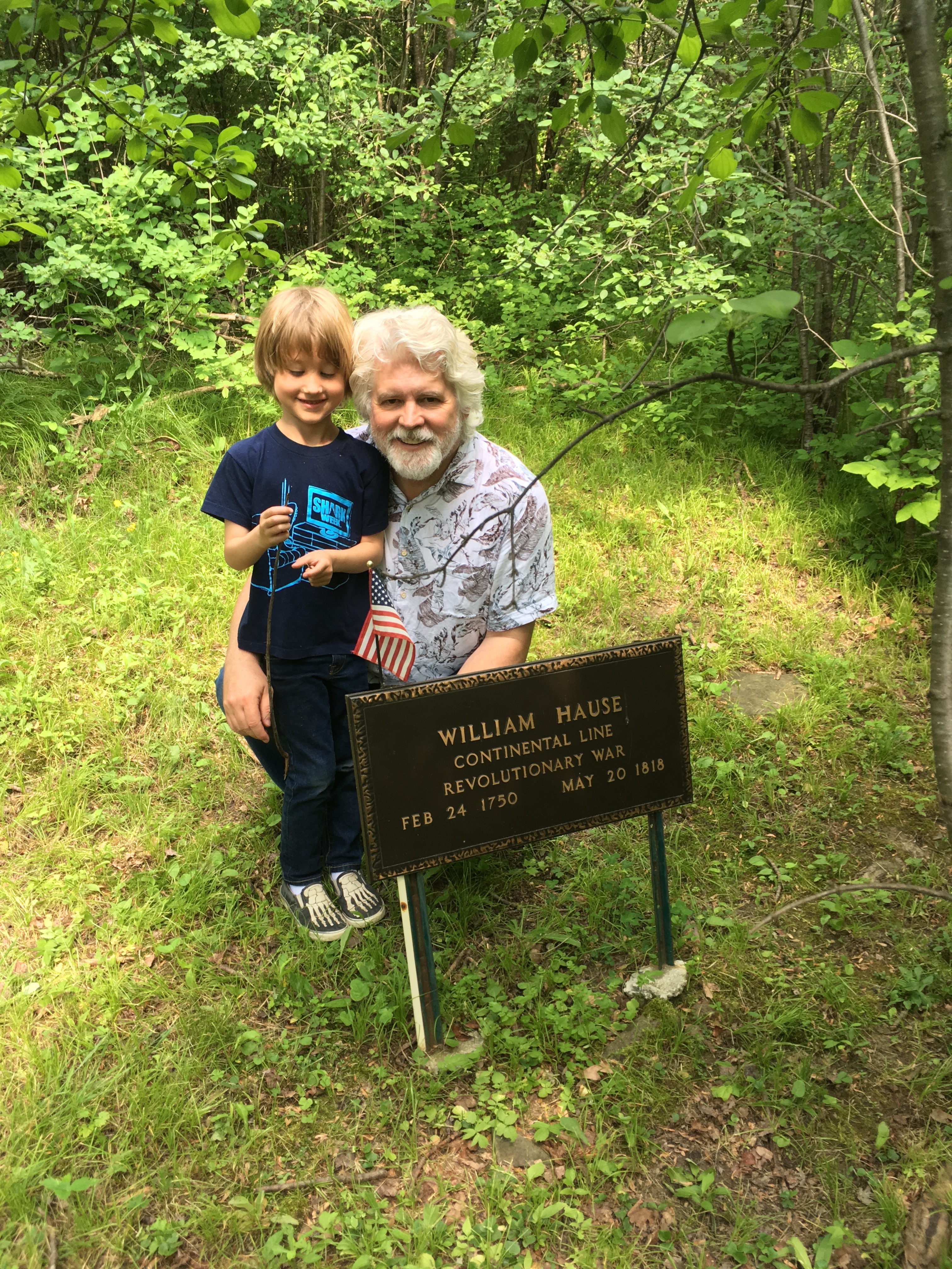
Atticus Hause (Jeff10, Carl9, Carl8, Carl7, Frank6, Laban5, Augustus4, John3, William2, John Hause1) in front of Baird's Tavern in 2022. The Historical Society of the Town of Warwick has maintained the structure since 1991. The lower floor is still being leased as a tavern, while the second floor and attic are museum space.
|
|